| Bibliography | Navigation map | Photo index | Acknowledgements |
 |
|
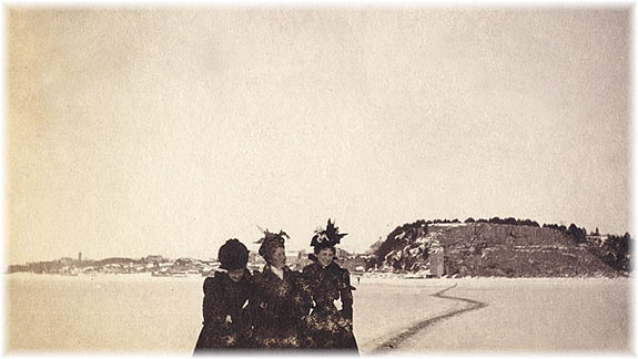
The winter path across the river. |
|
This shows the three ladies preparing to cross to Ottawa on the winter path that meandered over the frozen river, between what are now Parc Laurier and Nepean Point. Residents of the two communities were accustomed to taking this precarious route before the Alexandra Bridge was constructed ? the first pier of the bridge, on the Ottawa side, can be seen under construction. Latitude North 45.42779 Longitude West -75.70620 |
| back to INTRODUCTION |